News
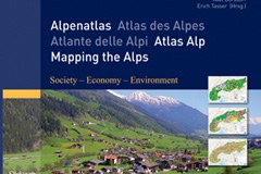
New publication: "Mapping the Alps"
Jun 19, 2008
/
alpMedia
With its international data sets and maps, this recently published atlas of the Alps provides a solid and up-to-date basis for a wide range of questions relating to the Alpine region. The editors see their work as a tool for studying the differences and the rapid pace of change in terms of place and society, which is so typical of the Alpine region in particular.
"Mapping the Alps" contains more than a hundred coloured maps of the Alps in its societal, economic and ecological aspects. Subjects like settlement patterns, income levels, landscape fragmentation or employment are interpreted with the help of various indicators by experts and their views presented in five languages (English, French, German, Italian and Slovene).
The target group for the atlas is the scientific community with an interest in the Alps from the fields of geography, tourism and economics, as well as politicians and informed members of the general public.
Bibliography: Borsdorf, A., Tasser, E. & Tappeiner, U. (eds.), 2008: Mapping the Alps. 292 pages. Spektrum Akademischer Verlag, ISBN 3-8274-2004-0.


